• 1700-700-729
  • salame@axis-gps.com
חיפוש
  • ראשי
  • אודותנו
  • המעבדה
  • המוצרים שלנו
    • דיסטומטים
    • Pix4D
    • GIS
    • מאזנות אופטיות
    • סורקי לייזר
    • קלטות
    • מציאות רבודה
    • רחפנים
    • ניטור
    • SITECH
    • MOBILE MAPPING
    • תוכנות
    • GNSS (מכשירי ג'י פי אס)
      • מקלטי GNSS
      • כרטיסים אלקטרוניים OEM
    • אביזרים וציוד מדידה
      • גלגלי מדידה
      • חצובות
      • מתאמים
      • פריזמות
      • רולטקות
    • מכשירי לייזר
      • לייזר שפועים
      • לייזר לבניה ועבודות בטון
      • לייזר לצנרת
      • לייזר קווי
      • מדי טווח לייזר
    • מיפוי ימי
  • פתרונות
    • רשת VRS
    • מודדים
    • קבלנים
    • שירותי מיקום של Trimble
    • SITECH
    • MOBILE MAPPING
    • GIS
  • Axis Campus
    • מאמרים
    • הדרכות מקצועיות
    • קורסי הכשרה מקצועית
  • צור קשר
לחצו להגדלה
עמוד הביתניטור Trimble Access Monitoring
מוצר קודם
Trimble 4D Lite
חזרה למוצרים
מוצר הבא
Trimble Alloy

Trimble Access Monitoring

[:he]
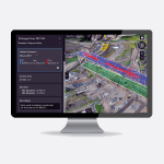
תוכנת שטח ליעול עבודות ניטור

Trimble Access הינו התוכנה המקצועית והמובילה בתחום המדידות
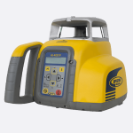
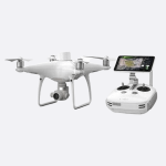
  • התקנת תחנה בקלות רבה
  • מדידה של פנים קדימה ופנים אחורה ושמירת מדידות לביקורים עתידיים
  • הוספת מקודות למסך ע"י מדידה, הכנסה ידנית (key in) או הכנסה מקבצי csv
  • הדגרת פרמטרי מדידה כמו מרווח האפוק (epoch) ו- tolerance

[:en]

Field software for configuring your monitoring projects

Trimble® Access™ continues to be the leading field software professional surveyors use around the world.

  • Easily set up a station.
  • Measure the backsight and all foresight targets and save their details to the job for subsequent site visits.
  • Add points to monitor by measuring, keying in, or importing from a .csv file.
  • Define measurement parameters such as epoch interval and tolerance.

[:]

השווה
הוסף למועדפים
קטגוריה: ניטור
שתף
פייסבוק טוויטר פינטרסט לינקדאין טלגרם
  • תיאור
  • חוות דעת (0)
תיאור

[:he]

Overview

Surveyors looking for a fast entry to deformation monitoring can take advantage of the Monitoring application for the Trimble® Access™ software suite. The Monitoring module guides surveyors through a step-by-step process that speeds up setup, data collection, reporting, and return visits to the same monitoring projects. The workflow is streamlined for regular, but not necessarily continuous, control and deformation surveys.

Output and Reports

  • View reports of displacement above the specified tolerance without the need for major analysis in the field.
  • View information on the measurement session while still in the field and then output reports that compare known coordinates with measurements over time.
  • Import the JobXML file into Trimble office software such as Trimble Business Centre or Trimble 4D Control for further processing.

Supported Instruments

The Trimble Access 2020 Monitoring software on Windows controllers supports all the instruments supported by Trimble Access including:

  • Trimble SX10 scanning total stations
  • Trimble S Series total stations


The Trimble Access 2017 Monitoring software on Trimble Windows Mobile/CE controllers supports the following Trimble instruments:

  • Trimble VX spatial stations
  • Trimble S6 total stations
  • Trimble S8 total stations


מערכות ניטור מודדות נקודות בזמן רציך של 24/7 ומחזירות התראה אם יש סטיות גדולות מהמותר, בכך מערכות ניטור יכולות למנוע התרסקות מבנים או אתרים כמו מחצבות ובכך גם למנוע אסונות ואובדן חיי אדם.

מערכת ניטור של חברת Trimble היא המערכת המובילה בתחום עם מגוון חיישנים ותוכנה עוצמתית השולטת על כל המערכת.

חברת Axis מציעה ציוד מדידה איכותי, מחפשת מכשיר מדידה שמתאים לצורכי מודד שטח. אצלנו תמצאו מגוון מכשירי מדידה למודדים וקבלנים, מערכות מידע גיאוגרפיות, כלים למיפוי, מכשירי ניווט, מיפוי אווירי, פוטוגרמטריה, פתרון לתצלומי אוויר,בתימטריה ופתרונות נוספים.

אצלנו תוכלו למצוא בין היתר: מכשירי GPS וקלטות, מערכות GIS, סורקי לייזר, רחפנים ותוכנות לעיבוד ענן נקודות, דיסטומטים (מד קואורדינטות), מיפוי בעזרת מציאות רבודה, כלים למיפוי ימי, מיפוי נע, מערכות שליטה על כלים, ניטור, תפרונות מיקום מתקדמים, רשת VRS, מאזנות אופטיות ולייזר ועוד.[:en]

Overview

Surveyors looking for a fast entry to deformation monitoring can take advantage of the Monitoring application for the Trimble® Access™ software suite. The Monitoring module guides surveyors through a step-by-step process that speeds up setup, data collection, reporting, and return visits to the same monitoring projects. The workflow is streamlined for regular, but not necessarily continuous, control and deformation surveys.

Output and Reports

  • View reports of displacement above the specified tolerance without the need for major analysis in the field.
  • View information on the measurement session while still in the field and then output reports that compare known coordinates with measurements over time.
  • Import the JobXML file into Trimble office software such as Trimble Business Centre or Trimble 4D Control for further processing.

Supported Instruments

The Trimble Access 2020 Monitoring software on Windows controllers supports all the instruments supported by Trimble Access including:

  • Trimble SX10 scanning total stations
  • Trimble S Series total stations


The Trimble Access 2017 Monitoring software on Trimble Windows Mobile/CE controllers supports the following Trimble instruments:

  • Trimble VX spatial stations
  • Trimble S6 total stations
  • Trimble S8 total stations


[:]

חוות דעת (0)

חוות דעת

אין עדיין חוות דעת.

היה הראשון לכתוב סקירה “Trimble Access Monitoring” לבטל

עליך להתחבר כדי לפרסם ביקורת.

מוצרים קשורים

השווה
סגור

Trimble 4D Control

[:he]תוכנה לניטור למדידה ובניה, מרכזת תוצאות מדידה של כל המכשירים באתר בזמן אמת שליטה מרחוק על מכשירים שונים, מדידה אוטומטית 24/7 התראות בזמן סטייה מהתקן https://www.youtube.com/watch?v=qdBDoCl-gh4&feature=emb_logo[:en]

Complete Monitoring Software for Survey and Construction Professionals

https://www.youtube.com/watch?v=qdBDoCl-gh4&feature=emb_logo[:]
הוסף למועדפים
מידע נוסף
צפייה מהירה
השווה
סגור

[:he]Trimble NetR9 Ti-M[:]

[:he]
מקסימום תכונות ופונקציונליות במכשיר אחד
המכשיר מציע ביצועים חזקים במיוחד המובילים עם 440 ערוצי GNSS של מספר מערכות לווינים ובשיתוף טכנולוגיות Trimble Maxwell™ 6 ו- Trimble 360.
[:en]
Maximum features and functionality from one piece of hardware.
Using the latest generation of Trimble 360 receiver technology in combination with two Trimble Maxwell™ 6 chipsets, the Trimble NetR9 Ti-M reference receiver offers an industry-leading 440 channels for unmatched GNSS multi-constellation tracking performance. With the world’s GNSS in constant development, the Trimble NetR9 Ti-M reference receiver provides the operator with the assurance that it has the capability to grow with the industry, both today, and well into the future.
[:]
הוסף למועדפים
מידע נוסף
צפייה מהירה
השווה
סגור

Trimble Settop M1

[:he]שליטה מרחוק על דיסטומטים של חברת Trimble https://www.youtube.com/watch?v=85FBujoowN8   https://www.youtube.com/watch?v=acEkzoXb3os&feature=emb_logo[:en]
  • This one-of- a-kind total station controller is a combination of a field computer, device server, router, cellular modem and remote switch
  • By merging these items into one device, field set-up is quick and simple
  • Data collection and storage is continuous; even when the internet connection is disrupted, measurement cycles will continue
  • Free subscription to IST Connect Cloud Service simplifies central server connection
  • Remote Total Station access delivers quick setup and configuration anytime

Overview

With the Settop M1 monitoring controller connected to a Trimble Total Station you will have the capability to quickly set-up for any monitoring applications, and receive reliable continuous data for decision making and reporting requirements. Working in conjunction with Trimble 4D Control software, the Settop dependably transfers data from the Total Station into T4D  to give you the data you need for monitoring in mining, buildings, dams and other structural monitoring applications.

Applications

The Settop M1 monitoring controller delivers high quality continuous data from a Trimble Total Station for the following:
  • Construction Monitoring
  • Structural Monitoring
  • Slope Monitoring
  • Mine Monitoring
123

Next steps

Control your total station through a simple to use setup with the Settop M1. Plug-in, and power, and you are ready to configure your next monitoring project. Read this article for more information on turning your total station into a real-time monitoring system. Settop M1 Total Station Controller
[:]
הוסף למועדפים
מידע נוסף
צפייה מהירה
השווה
סגור

Trimble Zephyr 3 Geodetic

תכונות
  • תמיכה ברשתות GNSS הבאות: GPS, GLONASS, Galileo, Beidou, QZSS
  • מעקב לווינים חזק בגובה נמוך
  • רב-שביל מופחת
  • פאזה ברמה של פחות ממילימטר
  • מושלם לתחנות רפרנס
  • אות משופרת בסביבות קשות
  • סינון LTE יפני
הוסף למועדפים
מידע נוסף
צפייה מהירה
השווה
סגור

Trimble OctoHub

[:he]פותח מגוון אפשרויות למשתמשים להתחבר למספר רב של מכשירים דרך Settop M1 מפחית בכמות הכבלים, לא צריך יותר לדאוג לאבד נתונים מחישנים, העברת נתונים פשוטה ומהירה[:en]

Opens up a wide range of possibilities for the user to connect to numerous diverse sensors and devices via their Settop M1.

With all of the multiple communication ports integrated in just one single device, with the new Settop OctoHub you can forget about complex cable counts in scenarios of reduced space, and you can also stop worrying about losing data from a specific sensor that needs to be analysed. You will have all of the data that you need within easy reach for a quick and easy analysis for all types of surveying work.

[:]
הוסף למועדפים
מידע נוסף
צפייה מהירה
השווה
סגור

Trimble Zephyr 3

[:he]עמיד ומדויק ברמה של פחות ממילימטר מגיע בשני דגמים: Base ו- Rover[:en]

Precise and durable with sub-millimeter accuracy

Comes with 2 models: Base and Rover

[:]
הוסף למועדפים
מידע נוסף
צפייה מהירה
השווה
סגור

Trimble S7

[:he] 

Trimble S7 - Robotic Total Station

דיסטומט גיאודטי רובוטי מתקדם, מדויק מתוצרת Trimble


https://www.youtube.com/watch?v=Vl2tJC06j4E    [:en]

Now you only need one instrument on the job site to perform all your data capture. Create 3D models, high accuracy visual site documentation, point clouds, and more using the Trimble S7, Trimble Access™ field software and Trimble Business Center office software.

  • Surveying, imaging and 3D scanning in one powerful solution
  • Improved Trimble VISION technology for video robotic control, scene documentation and photogrametric measurements
  • Trimble DR Plus for long range and superior accuracy
  • Complete field-to-office solution for quick data capture and processing
  • Seamless integrated surveying with Trimble GNSS receivers
[:ar]

Now you only need one instrument on the job site to perform all your data capture. Create 3D models, high accuracy visual site documentation, point clouds, and more using the Trimble S7, Trimble Access™ field software and Trimble Business Center office software.

  • Surveying, imaging and 3D scanning in one powerful solution
  • Improved Trimble VISION technology for video robotic control, scene documentation and photogrametric measurements
  • Trimble DR Plus for long range and superior accuracy
  • Complete field-to-office solution for quick data capture and processing
  • Seamless integrated surveying with Trimble GNSS receivers

[:]
הוסף למועדפים
מידע נוסף
צפייה מהירה
השווה
סגור

Trimble Ti-V2 Choke Ring

[:he]

תכונות

  • אות משופרת בסביבות אותות קשה
  • תמיכה ברשתות GNSS הבאות: GPS, GLONASS, Galileo, Beidou, QZSS
  • Jet Propulsion Laboratory
  • דיוק פאזה 2 מ"מ ופחות ממילימטר בחזרה
  • סינון LTE יפני
[:en]

Features

  • Improved signal reception in harsh signal environments
  • Comprehensive GNSS support, including GPS, GLONASS, Galileo, Beidou, and QZSS
  • Jet Propulsion Laboratory (JPL) Scientific Design
  • Extensive precision rotation-testing: ensures 2 mm or better phase-center eccentricity and < 1mm phase-center repeatability
  • Japanese LTE filtering
[:]
הוסף למועדפים
מידע נוסף
צפייה מהירה

חברת AXIS הינה חברת טכנולוגיות ופתרונות מתקדמים וחדשניים במגוון תחומים ובהם: המיפוי והגיאו-אינפורמציה, ערים חכמות, יישומים מדויקים מבוססי מיקום, פתרונות ניווט לרכבים אוטונומיים, HD Mapping, Mobile Mapping, חקלאות מדייקת, ,Construction Tech , Machine Control פתרונות ניטור ועוד.

תפריט ראשי

  • ראשי
  • אודותינו
  • המעבדה
  • רשת vrs
  • מאמרים
  • קורסי הכשרה מקצועית
  • הדרכות מקצועיות
  • הצהרת נגישות
  • מדיניות פרטיות
  • תקנון
  • צור קשר

המוצרים שלנו

  • דיסטומטים
  • Gis
  • Gnss
  • קלטות
  • סורקי לייזר
  • מאזנות אופטיות
  • Pix4D

פתרונות

  • מכשירי לייזר
  • רשת Vrs
  • רחפנים
  • תוכנות
  • אביזרים וציוד מדידה
  • קורסי הכשרה מקצועית

יצירת קשר

  • סניף ראשי: הסדנא,אזור תעשייה ציפורית.
  • סניף מרכז: איזור תעשייה, פארק אפק.
  • 1700-700-729
  • כל השבוע , כולל שבת 08:00 -17:00
  • salame@axis-gps.com

הרשם לקבלת עדכונים

© כל הזכויות שמורות לאקסיס ג'י פי אס ומכשירי מדידה בע"מ

אתר זה נבנה ע״י אונטו מדיה

  • ראשי
  • אודותנו
  • המעבדה
  • המוצרים שלנו
    • דיסטומטים
    • Pix4D
    • GIS
    • מאזנות אופטיות
    • סורקי לייזר
    • קלטות
    • מציאות רבודה
    • רחפנים
    • ניטור
    • SITECH
    • MOBILE MAPPING
    • תוכנות
    • GNSS (מכשירי ג'י פי אס)
      • מקלטי GNSS
      • כרטיסים אלקטרוניים OEM
    • אביזרים וציוד מדידה
      • גלגלי מדידה
      • חצובות
      • מתאמים
      • פריזמות
      • רולטקות
    • מכשירי לייזר
      • לייזר שפועים
      • לייזר לבניה ועבודות בטון
      • לייזר לצנרת
      • לייזר קווי
      • מדי טווח לייזר
    • מיפוי ימי
  • פתרונות
    • רשת VRS
    • מודדים
    • קבלנים
    • שירותי מיקום של Trimble
    • SITECH
    • MOBILE MAPPING
    • GIS
  • Axis Campus
    • מאמרים
    • הדרכות מקצועיות
    • קורסי הכשרה מקצועית
  • צור קשר
  • salame@axis-gps.com
  • 1700-700-729
  • ראשי
  • אודותנו
  • המעבדה
  • המוצרים שלנו
    • דיסטומטים
    • Pix4D
    • GIS
    • מאזנות אופטיות
    • סורקי לייזר
    • קלטות
    • מציאות רבודה
    • רחפנים
    • ניטור
    • SITECH
    • MOBILE MAPPING
    • תוכנות
    • GNSS (מכשירי ג'י פי אס)
      • מקלטי GNSS
      • כרטיסים אלקטרוניים OEM
    • אביזרים וציוד מדידה
      • גלגלי מדידה
      • חצובות
      • מתאמים
      • פריזמות
      • רולטקות
    • מכשירי לייזר
      • לייזר שפועים
      • לייזר לבניה ועבודות בטון
      • לייזר לצנרת
      • לייזר קווי
      • מדי טווח לייזר
    • מיפוי ימי
  • פתרונות
    • רשת VRS
    • מודדים
    • קבלנים
    • שירותי מיקום של Trimble
    • SITECH
    • MOBILE MAPPING
    • GIS
  • Axis Campus
    • מאמרים
    • הדרכות מקצועיות
    • קורסי הכשרה מקצועית
  • צור קשר