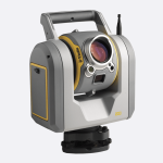
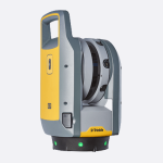
טאבלט Trimble T10 מביא יתרונות לשטח של מחשב חזק ומהיר עם מסך ענק.
כולל מקלט GNSS מובנה, נועד למודדים ועובדי GIS. משמש למדידות, מיפוי, איסוף מידע GIS בו זמנית ותומך באפליקציות Windows נפוצות.
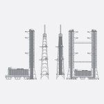
מאוד נוח לעבודה עם ענן נקודות בתצוגת תלת ממד
מגיע עם Windows 10 Enterprise
T10 הוא פתרון עוצמתי ואיכותי לשטח המשלב ביצועים, איכות ונוחות המשתמש